What is Geodatabase XML? – Excerpt from ArcGIS Help Below
Geodatabase extensible markup language (XML) represents Esri's open mechanism for information interchange between geodatabases and other external systems. Esri openly publishes and maintains the complete geodatabase schema and content as an XML specification and provides example implementations to illustrate how you can share data updates between heterogeneous systems.
XML interchange of geospatial information to and from the geodatabase is greatly simplified using the geodatabase XML specification. External applications can receive XML data streams including:
Exchange and sharing of full (as well as portions of) geodatabase schemas
Exchange of complete lossless datasets
Interchange of simple feature sets (much like shapefile interchange)
Exchange of change-only (delta) record sets using XML streams to pass updates and changes among geodatabases and other external data structures
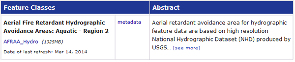
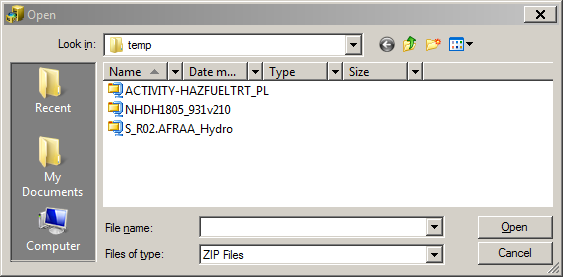
Download the zip archive by clicking the link in the Feature Class column. Save the file to a local or network disk.
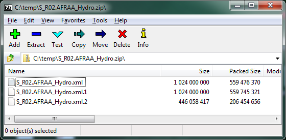
View the contents of the archive
Use an archive utility or your file browser to view the contents of the archive.
Note that smaller archives contain a single XML file, but large archives may contain several files, each containing part of the feature class in XML format.
ESRI users: ArcCatalog provides a utility for importing a single, uncompressed XML document, as well as the import of zip-formatted archives containing multiple files. If the archive contains multiple files, don't extract the contents. Instead, import the entire archive.
Other users: Extract the file(s) to the location of your choice. When necessary, use a text editor or script to consolidate multiple files into a single XML document.
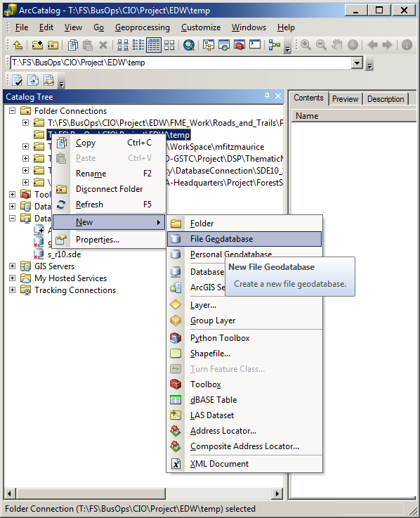
Create a File Geodatabase
An example for ESRI Users, using Arc Catalog v. 10.1
From Arc Catalog, right click the destination folder. New > File Geodatabase. Name the new File Geodatabase.
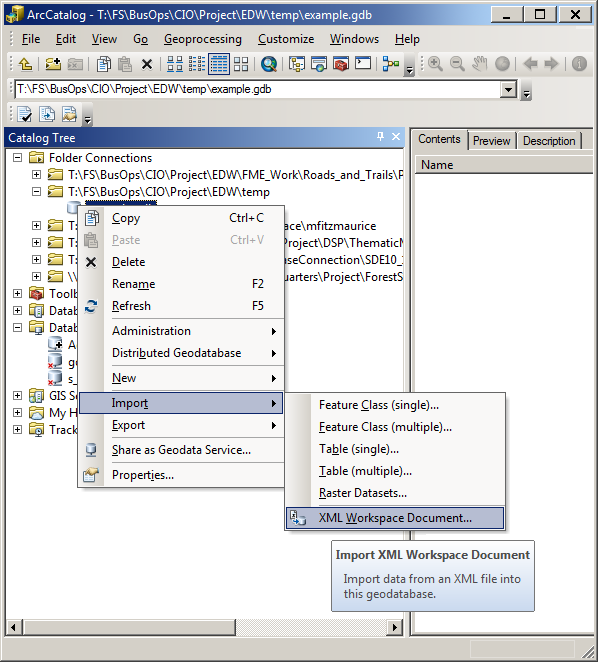
Right click your new File Geodatabase and choose Import > XML Workspace Document. From the file type drop down, select the file appropriate format, eg. *.xml, *.zip, then pick the file or archive to import. Follow:
Select the file or archive. Click OK > Next > Finish
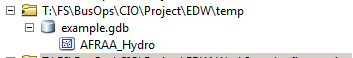
Your Geodatabase will now contain the contents defined in the XML file or archive (e.g., the AFRAA_Hydro Feature Class).
Using the Data
Now that you have successfully imported in the XML file to define your local geodatabase contents, you can interact with it as you would any other data on your system. For example, one could:
Continue to use the data in the File Geodatabase format
Export the data as a Shapefile for use in ESRI & Non-ESRI products
Export the data as a KML\KMZ file for use in Google Earth
For additional methods of accessing data via Map Services and\or downloading data as user defined extent File Geodatabase or Shapefile formats, please review the Geospatial Data Discovery Tool and Map Services sections of the Enterprise Data website.