Theme Name: BOUNDARY Theme Type: Line & Polygon Most recent update: April 16, 2008
The Forest boundary was digitized in-house using both ARC/INFO and LIDES. The Russian River and Chickaloon River portions of the boundary on the Kenai Peninsula were extracted from the STREAMS data theme which were digitized from 1:31,680 orthophoto quads. This coverage has both a Polygon Attribute Table (PAT) and an Arc Attribute Table (AAT) with accompanying attributes. The management areas are from the 1984 Chugach National Forest Plan.
Metatdata can be viewed in ArcCatalog for each feature class.
This information is being shared as a prototype. The Forest Service cannot assure the reliability or suitability of this information for a particular purpose. Original data was compiled from various sources. Spatial information may not meet National Map Accuracy Standards. This information may be updated, corrected, or otherwise modified without notification. For additional information about this data, contact Erik Jackson at (907) 743-9574.
 Theme Name: BOUNDARY
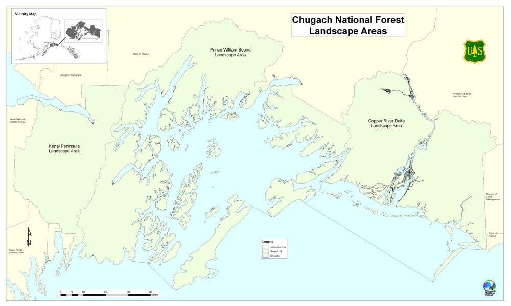