Theme Name: LANDSTAT Theme Type: Polygon Most recent update: November 29, 2011
Digitized in-house in 1988-89 both with LIDES and in ARC/INFO from the Land Status Atlas maintained by the Chugach National Forest Supervisor's Office Lands Staff. Coverage is updated as new conveyances are received.
Metatdata can be viewed in ArcCatalog for each feature class.
This information is being shared as a prototype. The Forest Service cannot assure the reliability or suitability of this information for a particular purpose. Original data was compiled from various sources. Spatial information may not meet National Map Accuracy Standards. This information may be updated, corrected, or otherwise modified without notification. For additional information about this data, contact Erik Jackson at (907) 743-9574.
 Theme Name: LANDSTAT
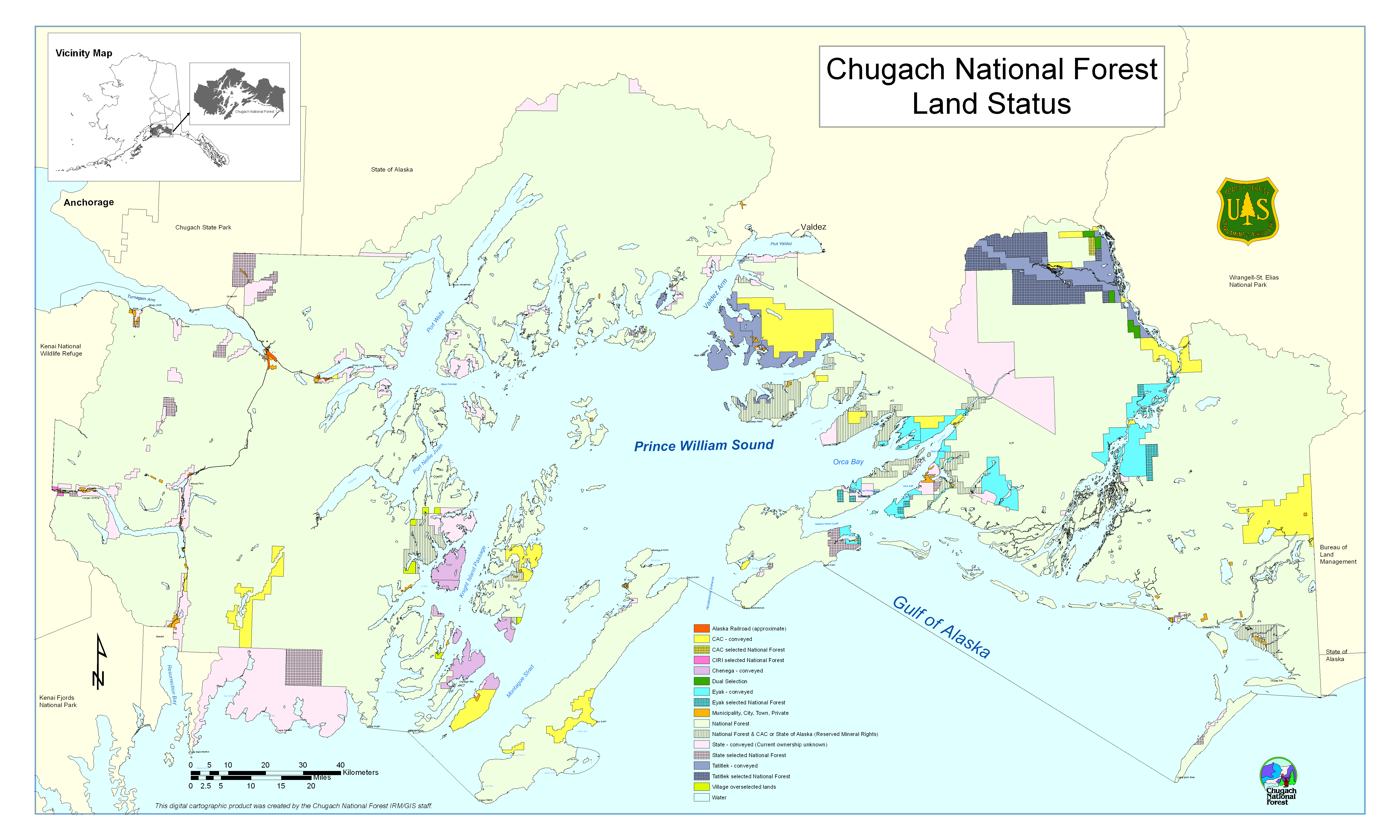