Theme Name: TIMTYP Theme Type: Polygon Most recent update: June 17, 2008
Existing timber type mylars were developed by the Alaska Regional Office in 1978 using 1:15,840 aerial photography flown in the 1950's-1970's, and digitized primarily under contract. The North Slope Borough digitized the Big Islands and Gravina Management Areas. Other full quads were done primarily by the Brodie Group. The remaining quads were done by the Chugach NF staff using LIDES or ARC/INFO. Additional mapping was done by Bob Green for the BLM Window and Whittier. Warren Oja did mapping for Cooper Landing. The forty quads under contract were as follows: Anchorage A1-A4, Bering Glacier A8 & B8, Cordova A1-A2, Cordova B1-B5, Cordova C3-C4, Middleton Island D1/2, Seward A3-A4, Seward B2-B8, Seward C1-C8, Seward D1-D5, Seward D7-D8.
Metatdata can be viewed in ArcCatalog for each feature class.
This information is being shared as a prototype. The Forest Service cannot assure the reliability or suitability of this information for a particular purpose. Original data was compiled from various sources. Spatial information may not meet National Map Accuracy Standards. This information may be updated, corrected, or otherwise modified without notification. For additional information about this data, contact Erik Jackson at (907) 743-9574.
 Theme Name: TIMTYP
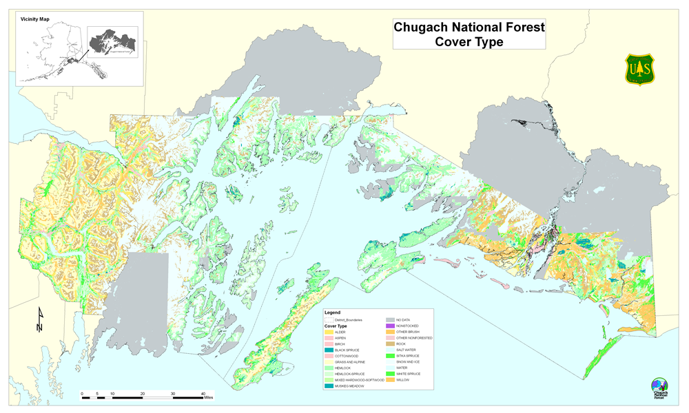