Theme Name: WETLANDS Theme Type: Line & Polygon Most recent update: October 29, 2008
Data received from US Fish & Wildlife Service. Wetlands interpreted stereoscopically and transferred to USGS base maps at 1:63,360 scale. Field verification/ground truthing in 8/79, 6/84, 8/85, 8/87, 6/88, 8/90. Total ground truthing time for the Chugach was 5 weeks. Coverage for the Chugach is only about 95% complete. There are no plans at this time to map these areas.
Metatdata can be viewed in ArcCatalog for each feature class.
This information is being shared as a prototype. The Forest Service cannot assure the reliability or suitability of this information for a particular purpose. Original data was compiled from various sources. Spatial information may not meet National Map Accuracy Standards. This information may be updated, corrected, or otherwise modified without notification. For additional information about this data, contact Erik Jackson at (907) 743-9574.
 Theme Name: WETLANDS
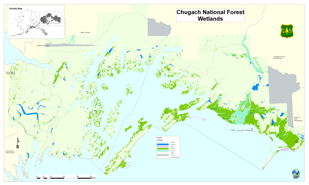