The Puerto Rico Gap Analysis Project (PRGAP) is a comprehensive assemblage of information on Puerto Rico's land cover, vertebrate occurrences and natural history information, and land stewardship.
It is based on methods developed by the national Gap Analysis Program (GAP) to determine the degree to which animal species and natural communities are represented in the current mix of conservation lands.
The PRGAP provides geographic and ecological information on the status of not only threatened or rare species, but the common species of Puerto Rico.
Those species or communities not well represented are considered conservation "gaps."
Authors: William A. Gould, Caryl Alarcón, Brick Fevold, Michael E. Jiménez, Sebastián Martinuzzi, Gary Potts, Maya Quiñones, Mariano Solórzano, and Eduardo Ventosa.
Maps and Data for download
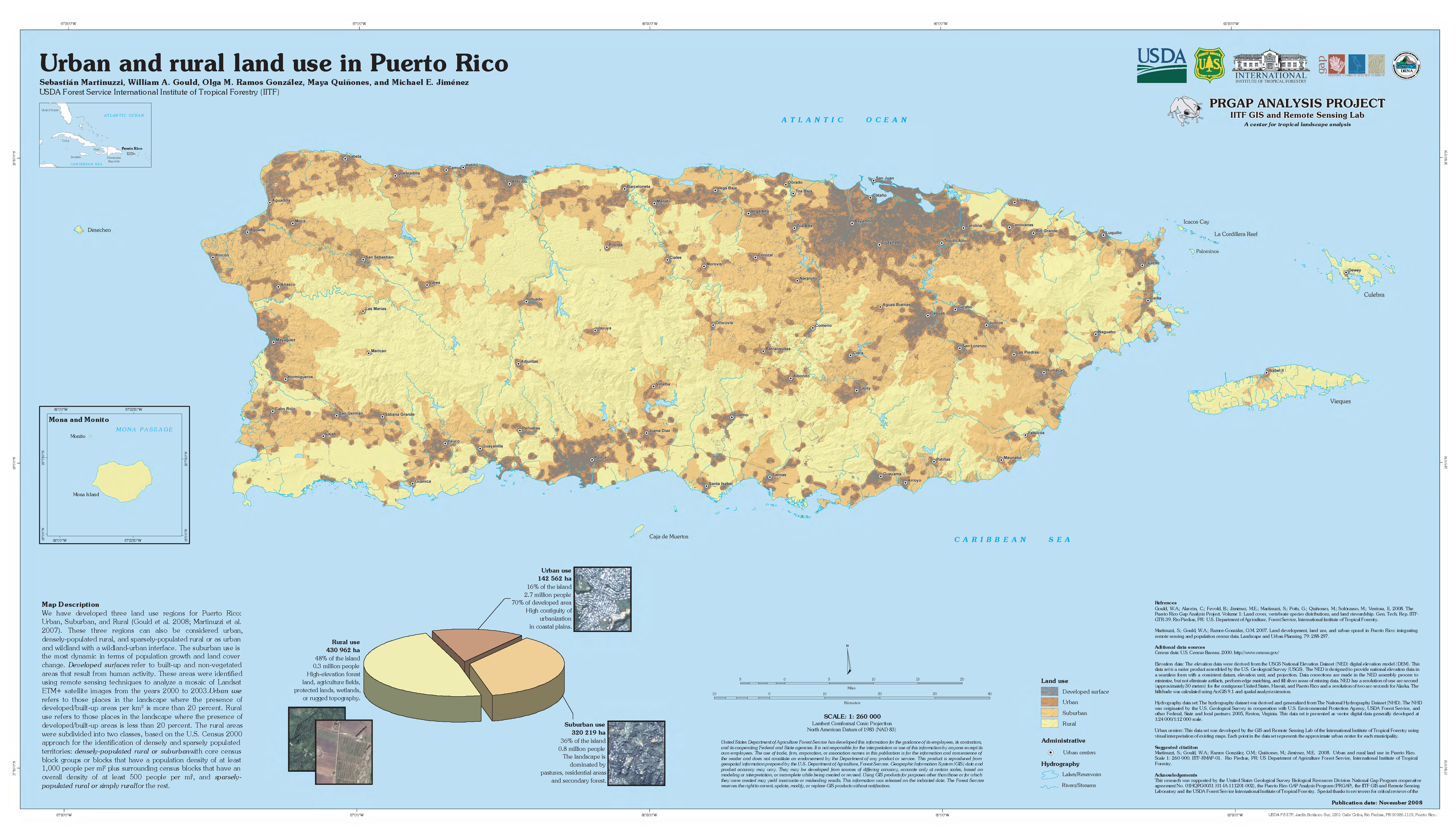
IITF-RMAP-01 Urban and rural land use in Puerto Rico
This map identifies three land use regions: Urban, suburban, and rural, and displays (built up) developed surfaces. The classification was made using information on the density of developed land and on human population distribution. The classification can aid in the understanding of how people use and develop the island and serve as a tool in land use planning.
ITF-RMAP-02 Protected Natural Areas of Puerto Rico
This map displays marine and terrestrial protected natural areas designated for natural resources conservation in Puerto Rico, as well as areas with government regulation that have the potential to protect natural resources.
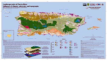
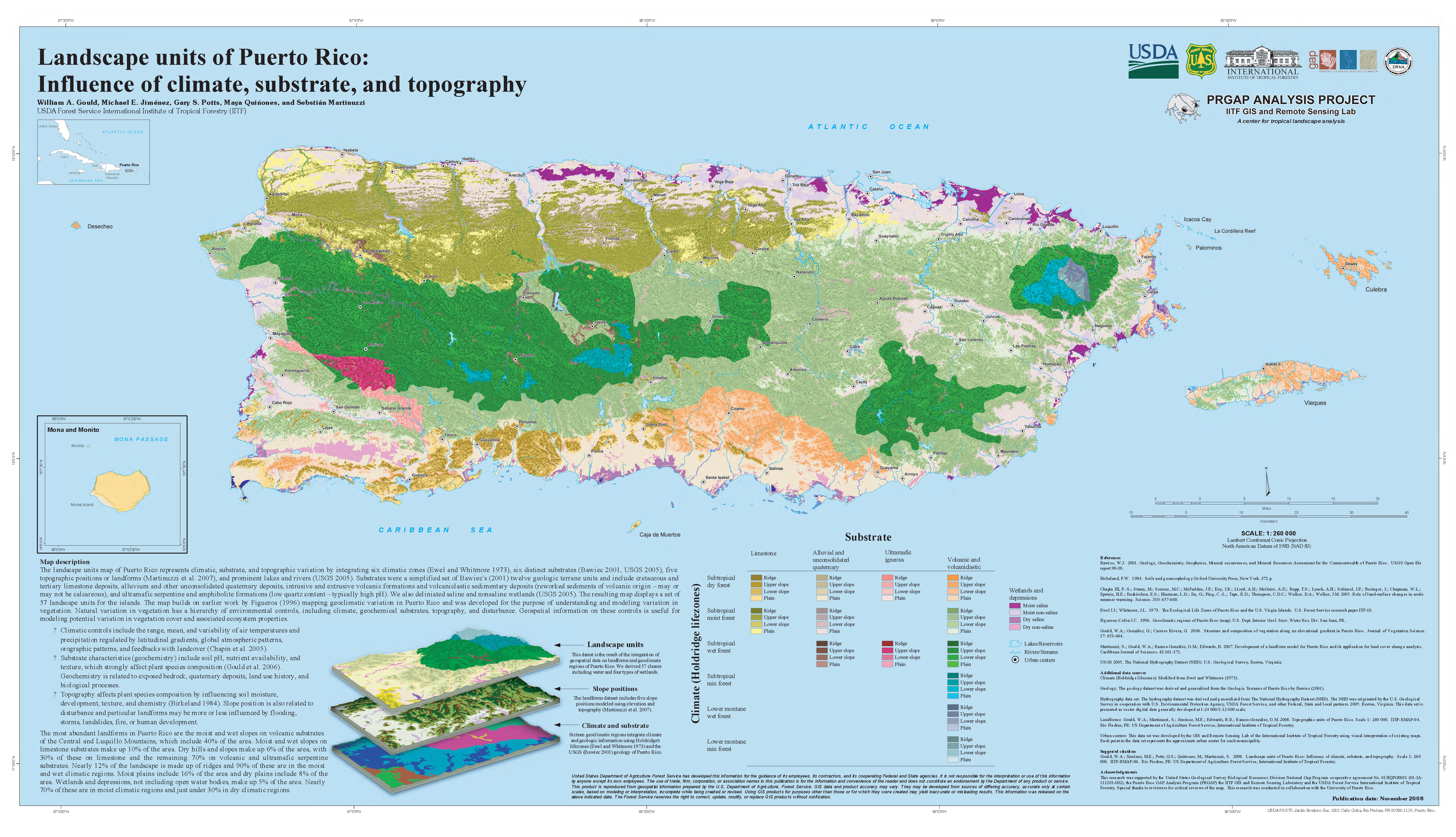
ITF-RMAP-06 Landscape units of Puerto Rico: Influence of climate, substrate, and topography
This map displays variation in thee landscape related to climate, substrate, and topography.