Infrastructure Notice: The Forest Service is undergoing significant infrastructure upgrades that will occur from late this week (starting July 24th) into the beginning of next week. Expect periodic outages during this time. Thank you for your patience as we continue to navigate toward new infrastructure!
The USDA Forest Service Geodata Clearinghouse is an online collection of digital data related to forest resources.
Through the Clearinghouse you can find datasets related to forests and grasslands, including boundaries and ownership, natural resources, roads and trails, as well as datasets related to State and private forested areas, including insect and disease threat and surface water importance.
You can also find downloadable map products, raster data, and links to other sources of forest resource information.
What's new?
Check out the latest Enterprise Data Warehouse (EDW) Factsheet which addresses such questions as: How is the EDW used? How do I get the data? How does the EDW operate? What are its priorities?
New National Monument boundary data – Recently, new national monuments have been designated on Forest Service lands. Boundaries of the national monuments can be found on the Downloadable data page in the dataset titled: “National Forest Lands with Nationally Designated Management or Use Limitations”. Information on how to obtain that data is found in this Frequently Asked question.
A single point of access for data collected and managed by the Agency. You can use the Geospatial Data Discovery Tool to access data about individual forests or grasslands or about an area of interest that you specify on the national map. You can find and download datasets by topic area or theme or find and use map services published by the Agency.
Rasters are digital aerial photographs, imagery from satellites, digital pictures, or even scanned maps. The Forest Service creates raster datasets for some Forest Service projects.
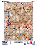
The Forest Service publishes a variety of map products. You can access the Interactive Visitor Map to help you plan your next adventure or enjoy your next visit, purchase forest visitor maps, national forest atlases and wilderness maps, and find and download other map products, including large scale topographic maps (FS Topo) and Motor Vehicle User Maps.
You can access the featured datasets, including boundaries, fire-related maps and data, forest health information, historical wilderness and wild and scenic river designation information, and data related to the Puerto Rico Gap Analysis Project.
Can't find what you are looking for? In order to help you find the data you are looking for, we have created a help page to guide you to select the type of data that best meets your needs, and that answers frequently asked questions.