Infrastructure Notice: The Forest Service is undergoing significant infrastructure upgrades that will occur from late this week (starting July 24th) into the beginning of next week. Expect periodic outages during this time. Thank you for your patience as we continue to navigate toward new infrastructure!
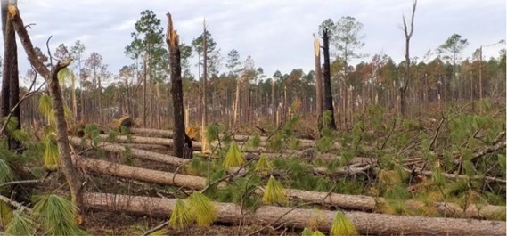
The Forest Service Hazard/Disaster Support Program assists forests, grasslands and associated cooperators in planning response and recovery activities associated with disasters and other extreme events. The program provides timely remotely sensed imagery, derived products, and other geospatial data and support services for tornados, hurricanes, landslides, derechos, and other types of non-fire hazards.
Requests for support after an event can be submitted by any Forest Service personnel through the Hazard/Disaster Support Hub Site (Forest Service internet access and credentials as well as an ArcGIS Online account required). Other entities or Forest Service personnel looking for support through the program should work with their local Forest Service office to submit a request.
The Hazard/Disaster Support program is coordinated by the Geospatial Technology and Applications Center (GTAC).
Data, Access and Use
Data produced by the Hazard/Disaster Support Program includes, but is not limited to, orthomosaics and image services created from imagery acquired by satellites, manned and unmanned aerial platforms, and change detection and damage assessment products derived from active and passive sensor systems. The resulting products are provided directly to forest units, used in web apps for further viewing and analysis, and/or made available as map or image services. Data types include:
Single and multiband imagery (provided in TIFF format unless otherwise requested)
Continuous and thematic raster data
Vector data (i.e. points, lines, polygons)
All of these are meant to be viewed using GIS software. Metadata are included with all files, providing geospatial details of the dataset, contact information, and proper citation information if you choose to further share the data.
Data for select recent events are also available via publicly available web maps. These web maps are typically published after an event for a prescribed duration to allow the Forest Service and their cooperators to easily view the data without direct use of geospatial software.
Imagery and Products
Typically, standardized products are provided dependent on the type of event. Imagery is the most commonly requested data, including moderate resolution Sentinel-2 imagery from the European Space Agency, and high-resolution imagery from WorldView and other commercial satellites. Since distribution of the data from commercial high-resolution sensors is limited by the licensing agreement, we cannot share it via this website. Parties interested in this imagery should contact the Hazard/Disaster Support Program (sm.fs.gtac-all-haz@usda.gov) to verify eligibility to receive this data.
Other than imagery, a variety of modeled and imagery-derived products are offered depending on the type of event. These include:
Forest Damage - Uses Sentinel-2 imagery from before and after an event to estimate the location and magnitude of change. 4 or 5 classes of damage are estimated using several raster change processes.
Wind Field - Typically created for hurricane events, this product models both maximum sustained and cumulative winds (combining wind speed and residency times) along the path of the storm.
TreeS-DIP (Tree Structure Impact Predictive model) - Uses a number of modeled inputs to estimate the extent of timber damage. Typically available within 48 hours of a storm.
Flood Probability - Uses space-based synthetic aperture radar (SAR) to estimate areas of potential flooding for non-forested areas. New sensors, anticipated to be launched in early 2024, should allow for flood detection in forested areas.
In addition to these products, customized requests for other products and services are possible provided we have access to the required input data and the resources to create that type of data.
Available Hazard/Disaster geospatial procducts are provided below. Each event type can be expanded by clicking on the "+" sign, with data grouped by Forest Service regions. For those not familiar with which states comprise each Forest Service region, follow this link.
Use Constraints: These data were collected from multiple sources, some which have specified use constraints. All data developed by the U.S. Government can be used without additional permissions or fees. Data developed by other sources may have other constraints.
Appropriate use includes local to forest-level assessments of changes to vegetation, potential damage to unit infrastructure, and/or direction of resources to estimate exact locations and amounts of damage.
There are use disclaimers and restrictions for specific data layers. Please review the information below under "Data Credit and Disclaimers" and consult any specifics for each dataset when downloading data.
Data Credits and Disclaimers:
Hazard/Disaster analysts use the best available remote sensing data to create output data to support field requests. Established analysis techniques are utilized to produce the required outputs, and when possible, field data is used to verify accuracy. Since products are created from remotely sensed data, users should be aware that the presented outputs are estimates of conditions at the times the data were acquired, and these do not represent absolute representations of damage states or conditions on the ground.
For all data layers you are free to share, copy, and redistribute the material in any medium or format AND adapt, remix, transform, and build upon the material for any purpose, even commercially under the following terms:
Attribution - You must give appropriate credit, provide a link to the license, and indicate if changes were made. You may do so in any reasonable manner, but not in any way that suggests the licensor endorses you or your use.
ShareAlike - If you remix, transform, or build upon the material, you must distribute your contributions under the same license as the original.
No additional restrictions - You may not apply legal terms or technological measures that legally restrict others from doing anything this license permits.